
What can JVFR do
Everything below is in the app today. It's a hobby project, so some corners are rougher than others, but I fly with it constantly and it has never let me down.
The map
Airspaces you can actually read
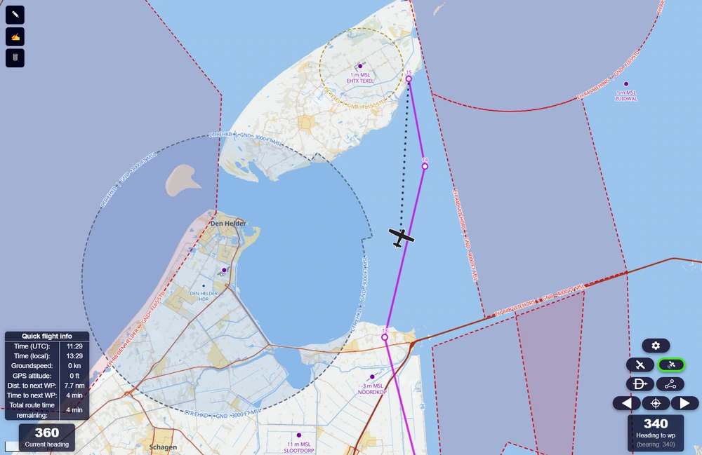
Vector based rendering allows for performant, clean and legible maps, with airspaces that can be styled by category and altitude band.
Declutter the stuff that is not relevant for your current flight: don't want to be reminded of the TMZs all over the Netherlands? Turn them off!
Offline
Fully custom offline maps
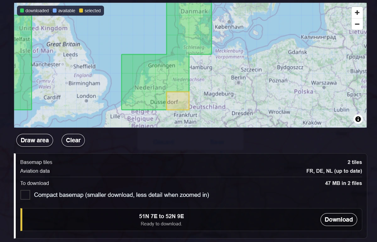
Draw a square over the area you fly and JVFR downloads it as 1° tiles: terrain, water, roads, towns, railways and country borders, plus the aviation data for every country the area touches. Data is stored on your device, so everything works in the air with no coverage.
You choose full detail or a compact version, and you choose which parts of the world to include. JVFR uses only as much storage as you want it to.
In the air
Fully functional aeronautical navigation
Plan a route and JVFR gives you tracks corrected for wind and magnetic variation, a per-waypoint ETA, and Direct-To navigation for airfields or FIRs. Glide range and endurance can be displayed on the map as well, all corrected for wind.
JVFR also looks ahead. It projects your ground track forward and warns you before you enter controlled airspace, a restricted or danger area, or an RMZ, with how long you have.
Weather
METARs, TAFs, and other weather stuff
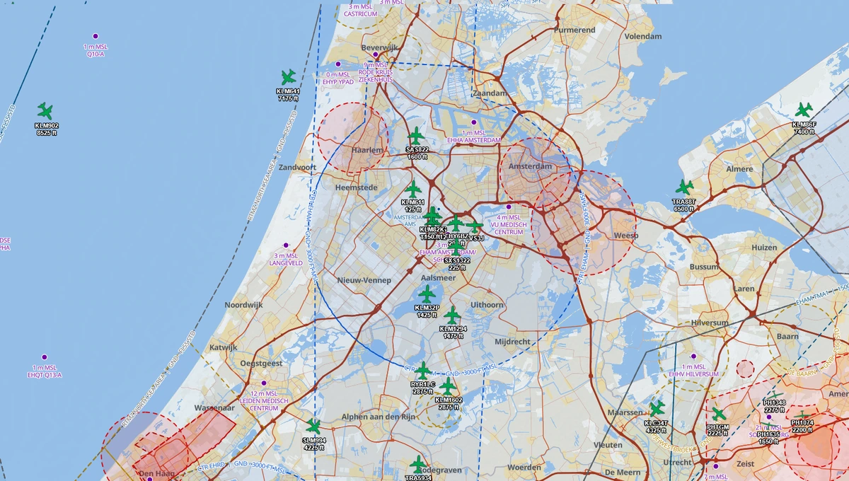
Decoded METAR and TAF for any reporting station in the world, rain radar and satellite imagery, winds at altitude, and crosswind components worked out for you rather than on your E6B.
Weather keeps updating in flight, so long as you still have a signal. If you lose it, the last received data is still shown on the map.
Wind
See the wind, wherever she blows
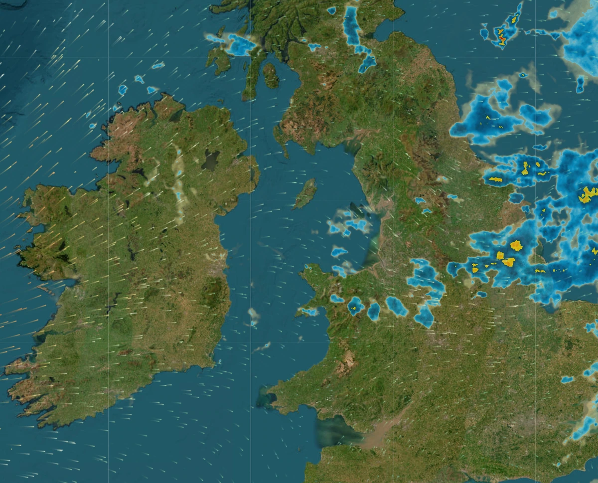
Wind at the surface, at 3000 ft and at 5000 ft, drawn as moving particles to visualize flows. Useful for picking a cruising level, for working out which way the day is going, and for knowing what is waiting for you on final.
The animation on the right is live GFS data, running the same renderer that is in the app. Looks cool right?
Loading live wind data…
On the ground
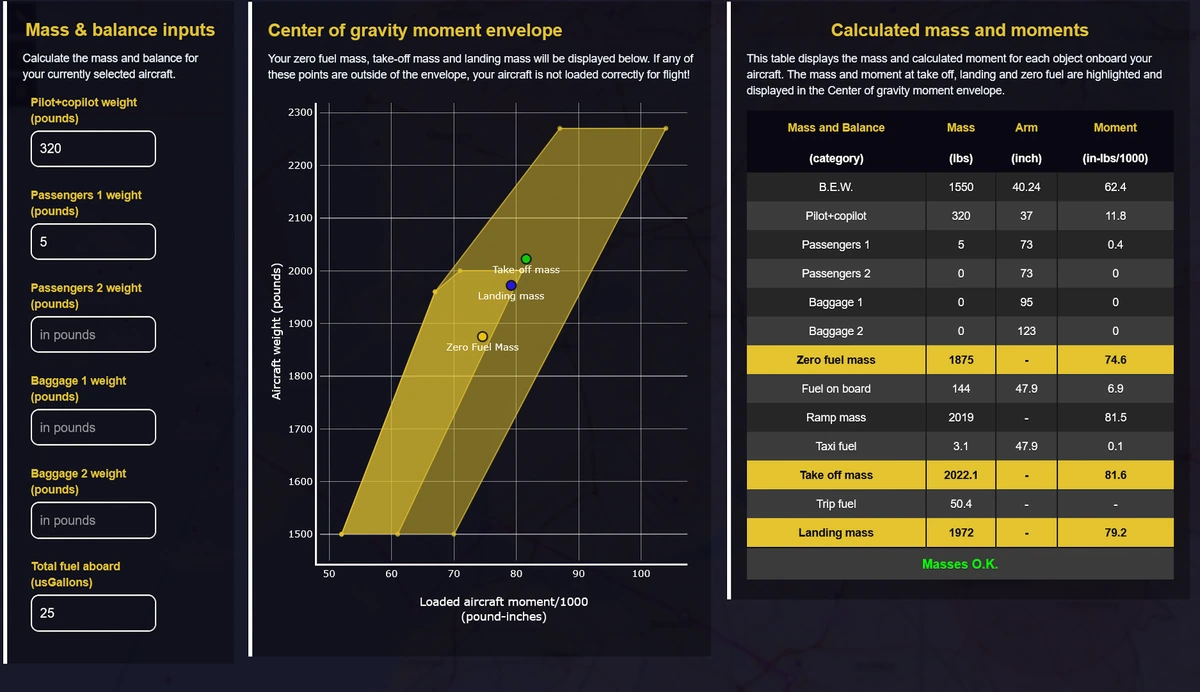
Mass, balance and fuel, without a spreadsheet
Enter your aircraft profile once — empty weights, arms, capacities, burn rate — and the loading diagram updates live as you change who and what is on board. Fuel planning covers taxi, climb, trip, contingency, reserve and alternate, and tells you plainly whether you have enough.
In whatever units you prefer. Pounds and gallons, kilograms and litres, or an unholy mixture of the two.
Briefing
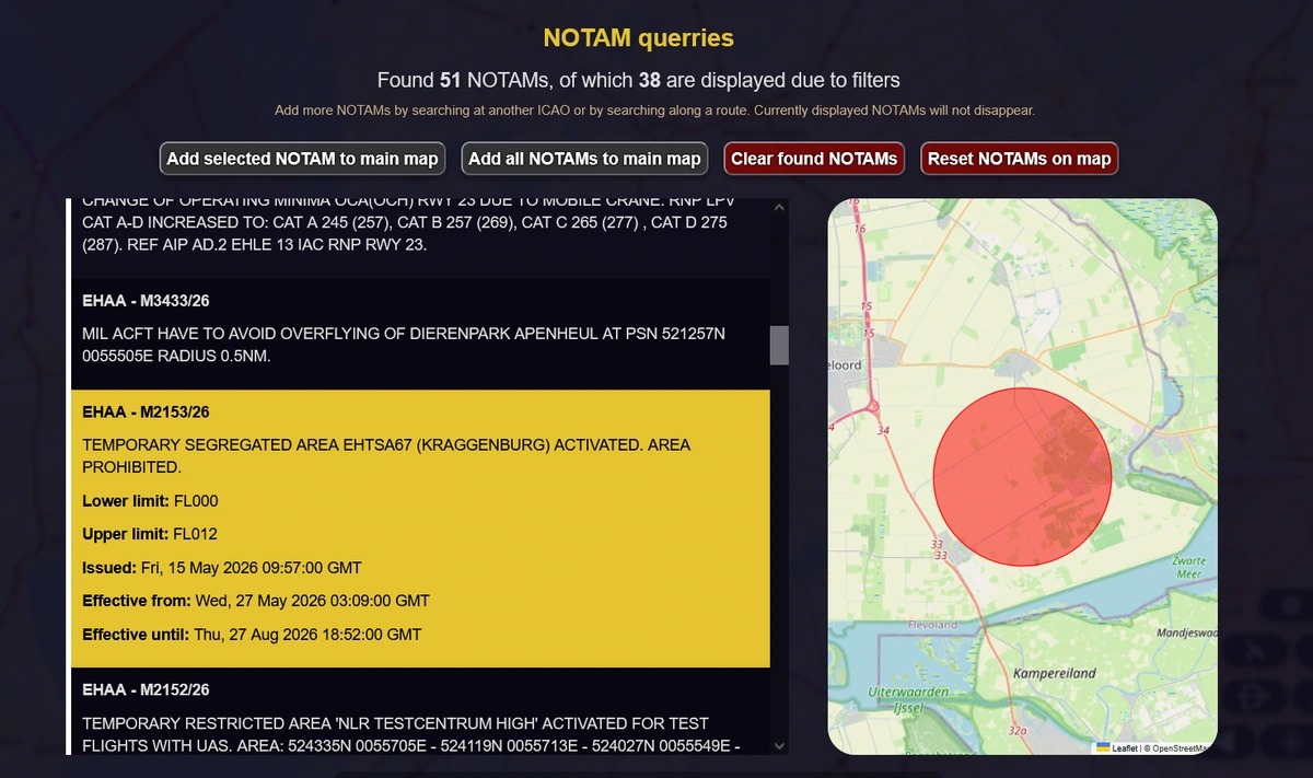
NOTAMs you can stand to read
Pull NOTAMs for an airfield, an FIR, or everything along your planned route, then filter out the ones that do not apply to your flight. The ones that matter can go on the map so you see them where they are, not as a wall of capital letters.
And the rest
Smaller stuff that adds up
Global coverage
Airspace, airfields and navaids worldwide. Check Tokyo, brief Chicago, fly Iceland. No regional packs to buy.
Eight map themes
From a printed-chart look to a night theme and an amber cockpit-CRT theme that protects your dark adaptation.
Terrain relief
Optional hillshading under the chart so ridges and valleys are obvious at a glance.
Flight logging
Your flights are recorded as you fly and saved to a logbook, with the track, duration and distance.
Aerodrome lookup
Runways, frequencies and details for airfields worldwide, with a map of the field.
Crosswind calculations
Calculate crosswind components for your approach and takeoff, so you know whether it is safe to proceed.
Glide range calculations
Dynamically visualize glide range for your aircraft, taking wind into account, so you know how far you can reach in an engine-out scenario.
Direct-To navigation
When your plan changes, punch in an ICAO code and JVFR gives you a track to fly straight there.
Try it on your own field
Open JVFR, download the area you fly, and see whether it earns a place in your flight bag.
Get JVFR