
Full VFR flight preparation, in one place.
GPS navigation, offline charts, Weather, NOTAMs, traffic, mass & balance, and various calculators, on any android or iOS device you have.
Download the app and fly today.
Try it right here
This is the actual map, not a screenshot
Below is a real JVFR offline data package for the Netherlands, drawn by the same code, in the app's default chart theme. Drag it around and have a look.
- Custom AIP styling Blue for controlled airspaces and CTRs, red for restricted, danger and prohibited areas, grey for RMZ and TMZ. In the app you can declutter and style to your liking.
- Interactive airspaces Read airspace features, ceilings, NOTAMs and more straight from the map.
- Fully offline Terrain, water, roads, towns and airspace are all stored on your device. Well, not on this website. This website needs internet. Obviously.
Loading the offline package…
Built for cockpit/pilots
Made by a pilot who got tired of checking ten websites
JVFR started during my PPL training, to pull weather, NOTAMs, charts and mass & balance into one place. I still routinely update the app with new features I want to have in the cockpit, and I hope you find them useful as well.
Powerful vector maps
Performant maps with dynamically rendered features. Labels are legible at any zoom or rotation. Tap any airspace to see its vertical limits and class.
Offline charts
Download just the area you fly and the map keeps working with no internet. Terrain, roads, towns, water and airspaces, all stored on your device.
GPS navigation
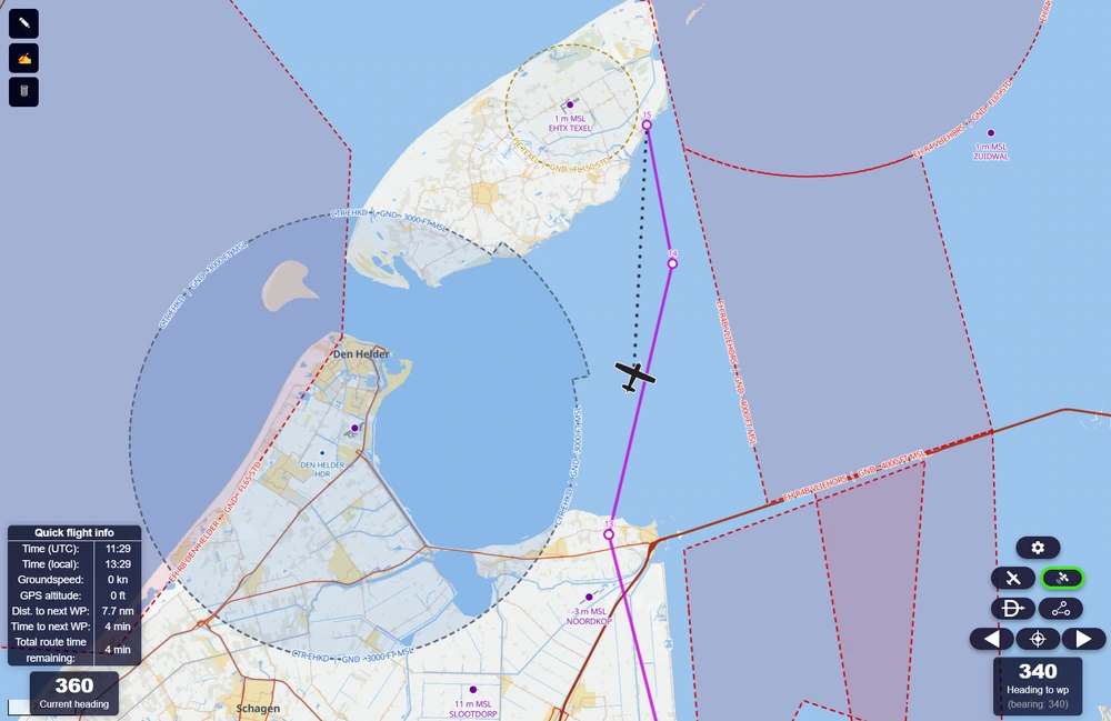
Track your route with wind and magnetic declination and variation applied, per-waypoint ETA, Direct-To, and an alerts before you enter controlled or restricted airspaces.
Complete weather suite
Decoded METAR and TAF for any reporting station, rain radar and satellite imagery, global winds at various altitudes, and automatic crosswind components for the runway you want to use.
Mass & balance
Live mass and balance as you change the loading, with fuel planning and reserves. In whatever units you prefer (personally, I quite like kilograms).
Live traffic
ADS-B and MLAT traffic around you, with a warning when something is getting close.
Offline maps
Downlooad only what you need
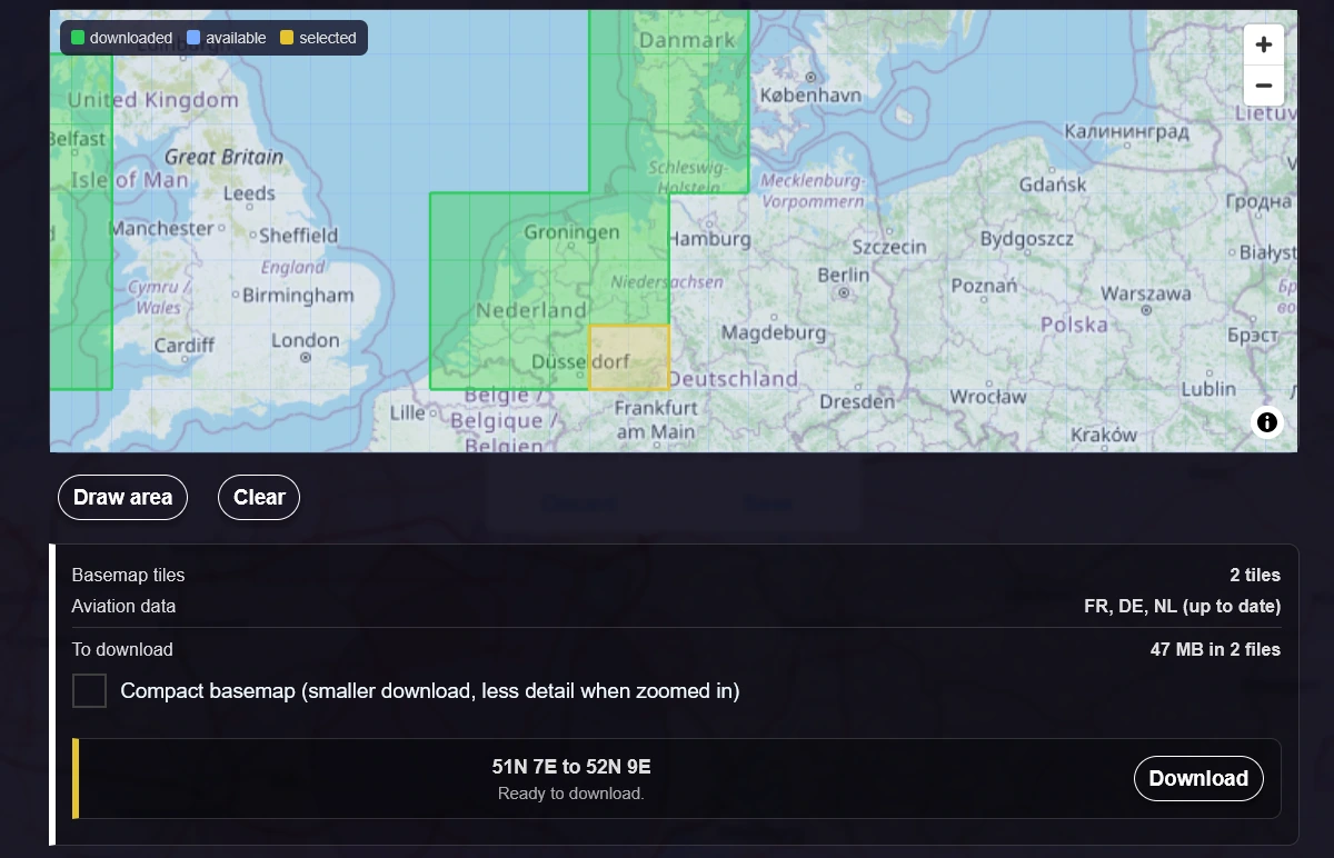
Pick the area you fly on a map and JVFR downloads it for you so you take only what you need, instead of whole countries or continents. The aviation data for every country your area touches comes along, in the same download.
Choose full detail or a compact version, see exactly what it will cost in megabytes before you download, and delete an area when you are done with it.
In flight
Dynamic navigation map
Your track, your route, and the airspaces ahead. JVFR watches where you are going and warns you before you enter a CTR, a restricted area or an RMZ, along with the time you have left before you get there.
Endurance and glide rings show how far you can actually reach, wind included, so "can I make it" has an answer.
Any device
Phone, tablet, laptop — same app
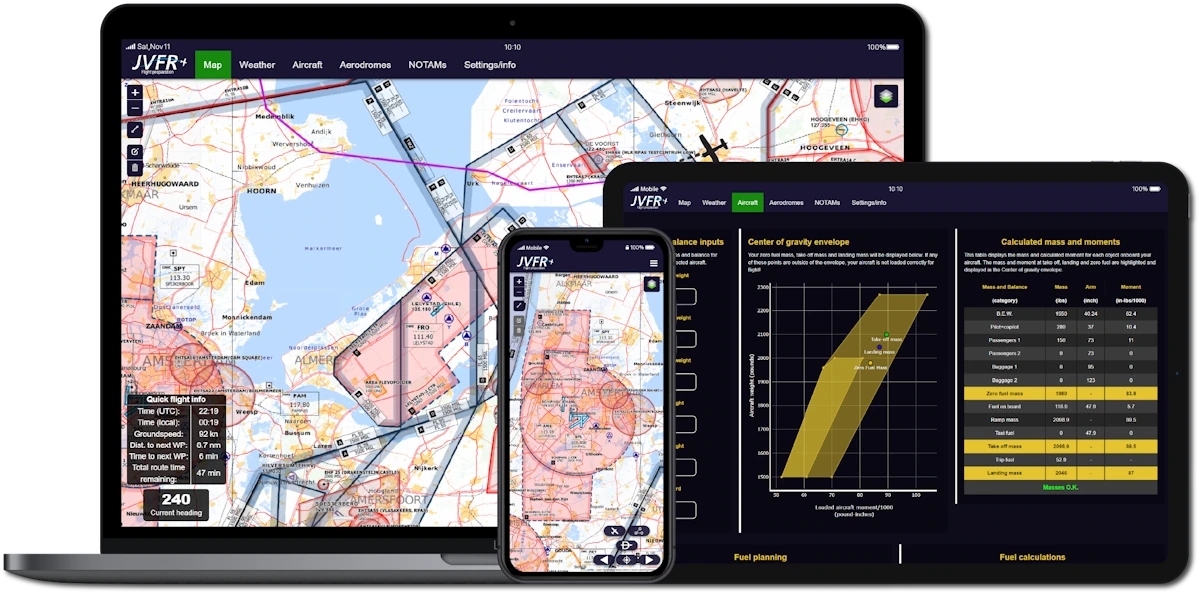
JVFR works on iOS, Android and Windows without a separate build for each. Add it to your preferred device and it opens like any other app, full screen, with your data already on the device.
Plan on the laptop the night before, fly with the tablet on your knee.
Latest
News & updates
Free now and forever
JVFR is a hobby project built on open data. There is nothing to pay for and nothing to unlock, just a free account so your aircraft can follow you between devices. If it saved you some time on the ground, you are welcome to put a coffee towards the hosting bill, but the app is yours either way.